[News Culture] Busan’s relationship with the sea is difficult to grasp from a single beach or observation deck. Along Namparang Trail Course 2, it reveals itself gradually—in cliffs and pebble shores, shaded mountain paths and neighborhoods built around the harbor.
Running across Yeongdo, the route brings together landscapes that rarely appear within one continuous walk. The sea remains close throughout, but its character keeps changing as the trail moves between nature, residential streets and sites shaped by the city’s modern history.
The shifting scenery keeps the journey from feeling repetitive, even over a distance of approximately 19.5 kilometers.
The full course takes around seven and a half hours. Although rated moderate, it demands a fair amount of stamina due to its length. Rest areas and attractions positioned along the route make the distance more manageable, but walkers should still allow a full day and prepare accordingly.
It is a route particularly well suited to travelers who are comfortable spending several hours on foot.
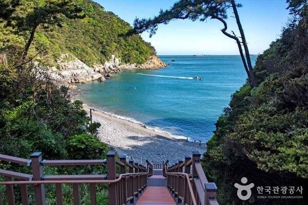
Taejongdae sets a dramatic tone at the beginning of the journey.
One of Busan’s best-known coastal landmarks, it is defined by steep cliffs, dense pine forest and an open sea stretching beyond them. The contrast between dark rock and shifting blue water gives the area a sense of scale that is difficult to capture from photographs alone.
Paths lined with Korean black pines move in and out of the forest, alternating between shade and broad views of the coastline. Sunlight filters through the branches, while wind rising from the sea offers relief along the way.
Observation points encourage walkers to stop and look outward. On clear days, ships can be seen moving slowly across the horizon, appearing almost motionless against the width of the sea.
As the opening section of Course 2, Taejongdae does more than provide scenery. It establishes the rhythm of the walk ahead—a route shaped by frequent changes between enclosed woodland and exposed coastline.
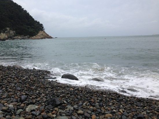
Beyond Taejongdae, the atmosphere softens at Gamji Beach.
Rather than fine sand, the shoreline is covered with rounded pebbles. Each wave pulls them together and then rolls them back toward the sea, producing a steady sound that follows walkers along the beach.
The effect is subtle but distinctive. Wind, waves and footsteps begin to fall into the same rhythm, turning the shoreline into a place to slow down rather than simply pass through.
After the dramatic cliffs of Taejongdae, Gamji Beach offers a quieter encounter with the coast. The horizon remains wide, but the experience becomes more intimate, shaped as much by sound and texture as by the view itself.
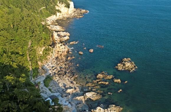
The trail opens up again along the Jeoryeong Coastal Walkway.
Running close to the water, this section offers some of the clearest and most expansive views on the route. Ships sit in the distance, clouds move over the horizon and the color of the sea changes with the light.
It is also one of the course’s most popular photography spots. Little staging is required. The uninterrupted meeting of sky and water provides its own composition, prompting many walkers to pause even when they had not planned to stop.
The walkway delivers a strong sense of space after the narrower paths and beaches behind it. A brief rest here is often enough to regain energy before the route turns inland.
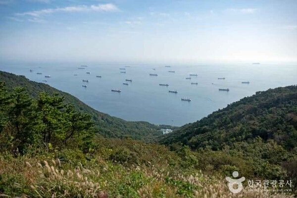
From the exposed coastline, the course continues toward the trail around Bongnaesan Mountain.
The change in temperature is immediately noticeable. Trees provide shade, the air feels cooler and the sound of the sea recedes behind the forest.
The gradients are generally gentle, making this section less demanding than its mountainous setting might suggest. Rest areas and mineral springs positioned along the trail provide convenient places to sit, drink water and recover.
The sea occasionally appears between the trees, offering brief reminders of the coastline below. These glimpses help connect the mountain path with the route’s earlier sections rather than making it feel like a separate journey.
Bongnaesan also reveals one of Yeongdo’s defining qualities: forest, city and harbor remain unusually close to one another. A wooded trail can feel remote for several minutes before opening onto signs of urban life again.
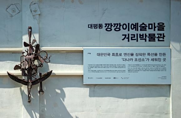
The mood changes once more as the trail descends into Daepyeong-dong and reaches Kangkangee Arts Village.
The neighborhood preserves the history of Yeongdo’s once-thriving ship-repair industry. Its name comes from the metallic “kkang-kkang” sound made by workers hammering rust and old paint from the surfaces of vessels.
That labor shaped both the physical landscape and the lives of the people who settled around the harbor. Workshops, docks and narrow alleys still carry traces of an era when shipbuilding and repair were central to the local economy.
Art and cultural projects have since added a new layer to the neighborhood. Murals and exhibition spaces appear among older industrial structures, drawing visitors through streets that might otherwise be overlooked.
The result is not a polished reinvention of the district. Its appeal lies in the way the past remains visible beneath the newer cultural identity.
Walking through the village offers a different kind of pause from those found at the beaches and forests. Here, attention shifts from natural scenery to the lives and labor that shaped Yeongdo.
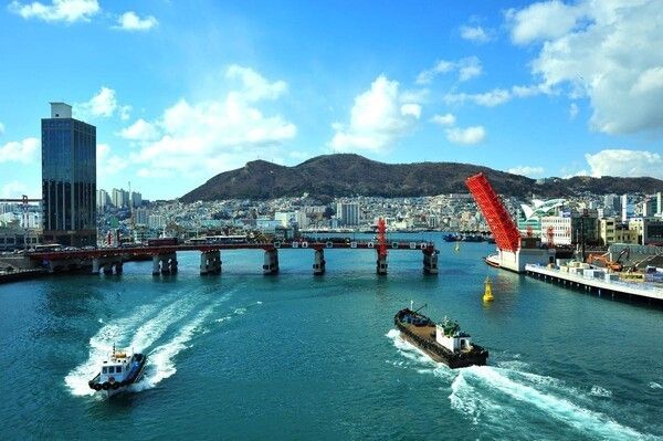
The final section of the route leads to Yeongdo Bridge.
As Busan’s first bridge connecting an island with the mainland, it has served as both a piece of infrastructure and a symbol of the city’s modern history.
During the Korean War, refugees gathered around the bridge in the hope of finding family members from whom they had been separated. The area became closely associated with displacement, reunion and the hardships endured by those who arrived in wartime Busan.
Crossing the bridge brings the journey back toward the center of the city. Jagalchi Market begins to appear across the water, signaling that the end of the route is close.
The view is markedly different from the open sea encountered at Taejongdae. Here, fishing vessels, markets, roads and buildings fill the waterfront, revealing the urban harbor that developed around the same waters.
That contrast makes Yeongdo Bridge a fitting conclusion. The route begins with cliffs facing the open sea and ends where the sea meets one of Busan’s busiest commercial districts.
Namparang Trail Course 2 is distinguished not by a single landmark but by the succession of places encountered along the way.
Cliffs give way to pebble beaches. Open coastal paths lead into shaded forest. The forest then returns walkers to neighborhoods shaped by shipyards, migration and harbor life.
It is the same island throughout, yet each section presents a different version of Yeongdo.
The route also rewards a slower pace. Covering the distance quickly would mean missing the gradual transitions that give the trail its character—the moment the sound of pebbles replaces the wind through pine trees, or the point at which the open horizon gives way to the narrow alleys of a working neighborhood.
There is no single viewpoint from which the entire journey can be understood. Its meaning accumulates over the course of the walk.
By the time travelers reach Yeongdo Bridge, Taejongdae’s cliffs, the rhythm of Gamji Beach, the openness of the Jeoryeong coastline and the industrial memory of Kangkangee Arts Village begin to feel like parts of one continuous story.
Namparang Trail Course 2 offers a way to experience Busan beyond its most familiar attractions. It is a coastal walk, but also a journey through the city’s geography, labor and memory.
Somewhere along those 19.5 kilometers, walking stops being a way to move between destinations and becomes the means through which Yeongdo reveals itself.
Reported by News Culture M.J._mj94070777@nc.press
Copyright ⓒ 뉴스컬처 무단 전재 및 재배포 금지


