The Ara Waterway forms a continuous waterfront corridor linking the lower Han River with the Yellow Sea. Running from Seoul's Gangseo District through Gimpo to Seo District in Incheon, the canal brings together urban infrastructure, riverside parks, ecological spaces and public leisure areas along a single watercourse. What was conceived as a navigation route has also developed into a landscape experienced on foot, by bicycle and from the water itself.
Beginning near the Han River estuary, the canal broadens into a straight waterway flanked by pedestrian promenades and cycling paths. The wide channel, open views and steady movement of the water establish a pace distinct from that of the surrounding city, while the uninterrupted waterfront creates a continuous visual axis extending westward.
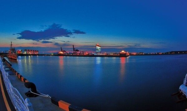
Jeongseojin marks the western threshold of the Ara Waterway. Here, the canal approaches the Yellow Sea, and the changing light of sunset spreads across the water in different tones throughout the year. The expansive skyline and unobstructed horizon distinguish the area from the dense urban landscape farther inland.
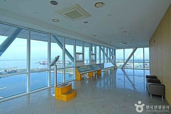
Ara Tower Observatory overlooks the full length of the canal from an elevated vantage point. Seen from above, the waterway appears as a linear corridor bordered by green spaces, recreational facilities and transportation infrastructure, revealing the relationship between engineered waterways and the surrounding landscape.
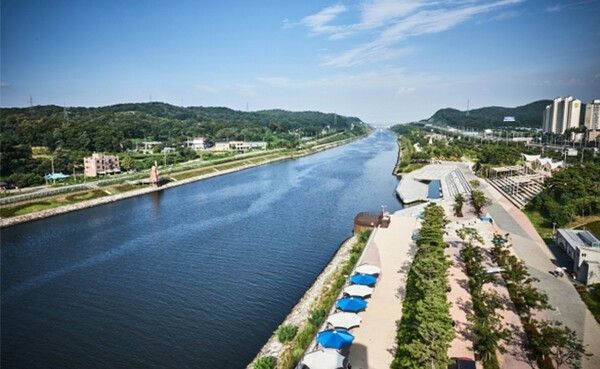
Ara Bit Island and Jeongseojin Plaza illustrate how the waterfront functions as both public open space and cultural venue. Broad plazas, walking routes and event areas are integrated into the shoreline, allowing everyday recreation and seasonal programs to coexist within the same setting.
The Sicheon Garamteo section presents another aspect of the canal. Although railways, roads and residential neighborhoods lie nearby, the waterway maintains a clearly defined spatial identity. Connected parks and riverside trails provide direct access from surrounding communities while preserving the continuity of the waterfront landscape.
Walking paths linked to Sicheon Park reflect the changing character of the seasons. Spring vegetation, summer shade, autumn foliage and the exposed contours of winter each reshape the appearance of the canal while maintaining its distinctive linear form.
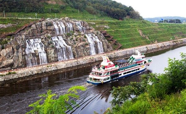
Ara Falls is an artificial waterfall designed to recreate the visual character of a natural cascade. Water descends over a high rock face in multiple streams, producing changing patterns of sound, mist and movement. Observation routes and terraced walkways allow the falls to be viewed from several elevations, emphasizing the vertical dimension of the landscape.
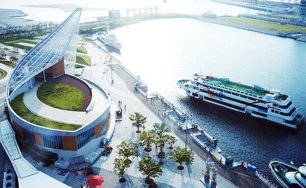
Aramaru Observatory extends over the canal on a cantilevered structure that gives the impression of floating above the water. Sections of transparent flooring reinforce the visual connection with the canal below, while the elevated platform frames a broad view of the surrounding waterfront and its contrasting natural and engineered elements.
The Gyeyang Araon district combines contemporary public spaces with architectural motifs inspired by traditional Korean pavilions. Sculptural installations, plazas and waterside promenades define the area as a cultural landscape shaped around slow movement and open public space.
Duri Ecological Park represents the environmental dimension of the Ara Waterway. While serving an important flood-control function, the park also preserves wetlands, grasslands and habitats for migratory birds. Boardwalks extending through the marshes allow close observation of the surrounding ecosystem without disrupting the natural environment.
The Gimpo and Incheon passenger terminals connect the canal with sightseeing cruises and other water-based activities. Public squares, cultural facilities and visitor amenities surround the terminals, reinforcing their role as gathering points within the broader waterfront corridor.
Nearby, Ara Marina introduces another layer to the landscape. Lines of moored yachts and leisure vessels reflect the canal's connection to recreational boating while marking the gradual transition from inland waterway to coastal environment.
Near Gimpo, the widening waterway reconnects with the Han River before continuing toward the Yellow Sea. The expanding surface of the water reflects the transition from river to estuary, bringing together the geographical elements that define the entire route.
Taken as a whole, the Ara Waterway is understood not simply as a transportation corridor but as a continuous landscape where waterways, public spaces, ecological environments and cultural facilities intersect. Stretching across the western edge of the Seoul metropolitan area, it presents a layered view of how infrastructure, nature and everyday urban life can occupy the same landscape.
Reported by News Culture M.J._mj94070777@nc.press
Copyright ⓒ 뉴스컬처 무단 전재 및 재배포 금지
본 콘텐츠는 뉴스픽 파트너스에서 공유된 콘텐츠입니다.


